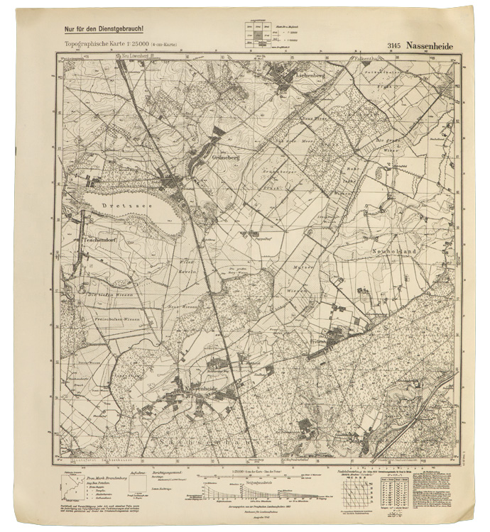
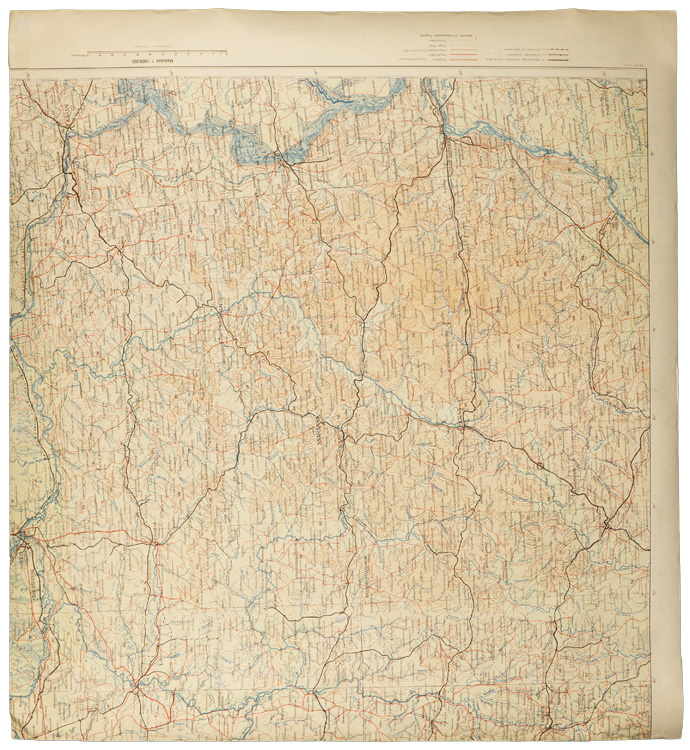
H052590 ARMY ISSUE MAP OF NASSENHEIDE & VICINITY. (Karte)
A 52.5cm x 58cm, printed, black and white, 1:25,000 scale army issue map of the Nassenheide region of Germany situated just south west of Berlin. The top edge of the map has printed script which includes, "Nur f³r den Dienstgebrauch!" (For service use only!). The map shows all of the topographical features of the region as well as cities, towns and villages, and the road and railway networks. The bottom edge of the map has printed script which includes, "Herausgegeben von der Preu▀ischen Landesaufnahme 1883, Reichsamt f³r Landesaufnahme, Ausgabe 1942", (Published by the Prussian Land Survey Office 1883, National Land Survey Office Published 1942). The map also has an additional printed date, "2. 1945". The map shows light age yellowing and has been stored rolled up so there are no fold creases. Interestingly the reverse of the map has an additional full color printed map of the "Ssaransk-Pensa", region of central Russia. The map also shows all of the topographical features of the region as well as cities, towns and villages, and the road and railway networks. The right side and the top edge of the Ssaransk-Pensa map have been cut-off but it does not affect the Nassenheide map on the other side.
GRADE **** PRICE $79.00
To Order this item, please use one of the two e-mail addresses below to contact us. Please make sure to quote the item number in your e-mail
MILITARIA WANTED! If you have items for sale, please contact us. We specialize in selling single pieces and entire collections. Over 3 decades in the business and we do all the work for you. Get the best return for your investment.
-E-Mail Address pawmac@nbnet.nb.ca Or guild@nb.aibn.com
To return to the main page please CLICK below